How Drone Agriculture Mapping Enhances Crop Management and Yield Predictions
In the modern agricultural landscape, technology plays a crucial role in optimizing productivity and ensuring sustainable farming practices. Among the...
In the modern agricultural landscape, technology plays a crucial role in optimizing productivity and ensuring sustainable farming practices. Among the most transformative innovations is drone agriculture mapping, which provides farmers with real-time insights to enhance crop management and maximize yield predictions. By utilizing drone data processing software, agronomists can analyze vast amounts of aerial data, detect patterns, and make informed decisions that improve efficiency and reduce costs.
From precision farming to disease monitoring, drone agriculture mapping is reshaping traditional farming methods, making them more data-driven and proactive. This guide explores the impact of drone technology on agriculture, how it enhances crop management, and how farmers can leverage it for accurate yield predictions.
The Rise of Drone Agriculture Mapping
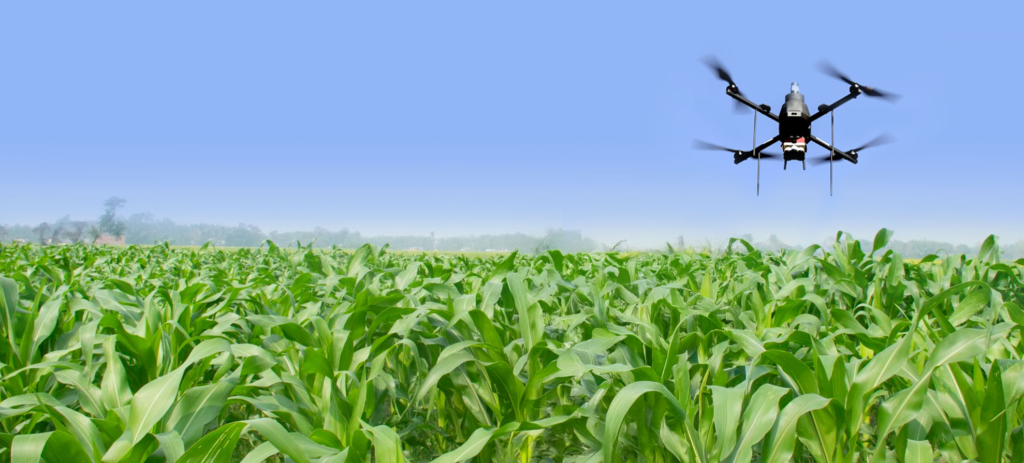
Agriculture has evolved significantly over the years, shifting from manual and labor-intensive techniques to data-driven precision farming. With the rise of unmanned aerial vehicles (UAVs), farmers now have access to a powerful tool that provides high-resolution images and real-time monitoring capabilities.
Drone agriculture mapping involves the use of drones equipped with advanced sensors, cameras, and LiDAR technology to capture detailed aerial images of farmland. These drones collect data on crop health, soil conditions, moisture levels, and pest infestations. The captured data is then processed through drone data processing software, which converts raw imagery into actionable insights.
By leveraging these insights, farmers can take proactive steps to improve field conditions, optimize resource utilization, and enhance overall productivity.
Key Benefits of Drone Agriculture Mapping for Crop Management
Precision Farming and Resource Optimization
Traditional farming methods often involve a one-size-fits-all approach, leading to inefficient resource usage. Drone agriculture mapping allows farmers to implement precision farming techniques by:
Identifying variations in soil composition and moisture levels
Mapping out precise irrigation zones
Adjusting fertilizer application based on real-time crop health data
With drone data processing software, farmers can analyze these factors and ensure that each section of the field receives the appropriate amount of water, nutrients, and pesticides. This targeted approach minimizes waste, reduces costs, and enhances productivity.
Early Disease Detection and Pest Monitoring
Crop diseases and pest infestations can significantly impact yield if not addressed promptly. Drones equipped with multispectral and thermal sensors can detect signs of plant stress before they become visible to the naked eye. Drone agriculture mapping helps:
Identify early-stage diseases by analyzing plant chlorophyll levels
Detect pest hotspots and implement targeted pest control measures
Prevent large-scale crop damage by responding swiftly to detected threats
Through drone data processing software, farmers receive detailed reports that highlight areas at risk, enabling them to take immediate action to protect their crops.
Soil Health Analysis and Land Mapping
Soil quality is one of the most important factors affecting crop yield. Drone agriculture mapping provides comprehensive insights into soil composition, erosion patterns, and fertility levels. By using drones to assess soil conditions, farmers can:
Create detailed 3D maps of their farmland
Monitor soil erosion and make necessary adjustments to prevent degradation
Implement site-specific farming techniques to optimize soil health
With drone data processing software, farmers can track changes in soil conditions over time, helping them refine their land management strategies for sustained productivity.
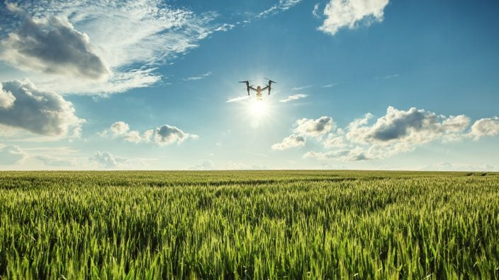
Real-Time Crop Health Monitoring
One of the biggest advantages of drone agriculture mapping is the ability to monitor crops in real time. Drones can conduct frequent field surveys, capturing high-resolution images that reveal patterns and trends in plant growth. This allows farmers to:
Track crop development from planting to harvest
Identify nutrient deficiencies and adjust fertilizer application
Evaluate the effectiveness of previous farming interventions
By analyzing drone-collected data through drone data processing software, farmers can make timely adjustments to their farming strategies, ensuring optimal crop health throughout the growing season.
Yield Prediction and Harvest Planning
Accurate yield prediction is essential for optimizing market strategies, planning logistics, and ensuring profitability. Drone agriculture mapping enables farmers to:
Estimate crop yield based on plant density and health data
Predict harvest times with greater accuracy
Optimize storage and distribution logistics
By integrating AI-driven drone data processing software, farmers can generate predictive models that forecast yield variations and market trends, helping them make data-driven decisions that enhance their profitability.
How Drone Data Processing Software Enhances Agricultural Insights
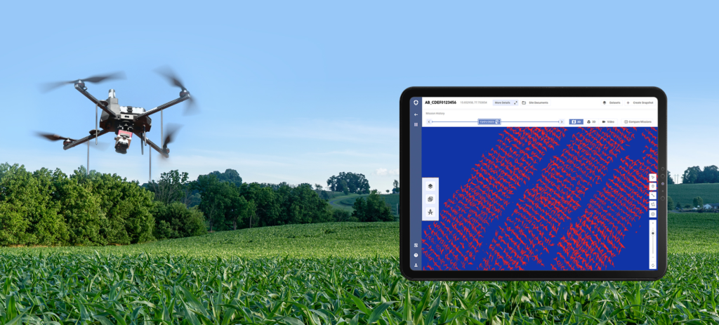
The power of drone agriculture mapping lies in the ability to transform raw aerial data into meaningful insights. Drone data processing software plays a crucial role in this transformation by:
Converting Raw Images into Actionable Maps
After drones capture high-resolution images of farmland, drone data processing software stitches these images together to create detailed maps. These maps can highlight:
Vegetation health using Normalized Difference Vegetation Index (NDVI) analysis
Soil moisture distribution and irrigation needs
Areas of potential disease outbreaks
Integrating AI and Machine Learning for Smarter Analytics
Modern drone data processing software incorporates AI and machine learning algorithms to analyze complex agricultural data. This enables:
Automated detection of anomalies in crop health
Predictive modeling for future yield outcomes
Custom recommendations for resource allocation
Providing Cloud-Based Access to Data
Farmers can access their drone agriculture mapping data from anywhere using cloud-based platforms. This ensures that:
Multiple stakeholders can collaborate on data analysis
Historical farm data is easily accessible for trend analysis
Data can be seamlessly integrated with other farm management software
Challenges and Considerations for Implementing Drone Agriculture Mapping
While drone agriculture mapping offers numerous benefits, there are certain challenges that farmers must consider:
Regulatory Compliance and Licensing
Many countries require farmers to obtain special permits to operate agricultural drones. Understanding local regulations is essential to ensure compliance.
Initial Investment Costs
While drones and drone data processing software can lead to long-term cost savings, the initial investment may be high. Farmers should assess their needs and choose solutions that provide the best return on investment.
Data Management and Interpretation
Processing large volumes of drone-captured data requires specialized software and expertise. Farmers may need to invest in training or partner with agricultural technology providers to maximize the benefits of drone agriculture mapping.
The Future of Drone Agriculture Mapping
As drone technology continues to advance, the future of drone agriculture mapping looks promising. Some emerging trends include:
Autonomous Drones: AI-powered drones capable of self-navigation and automated data collection.
Integration with IoT: Combining drones with IoT sensors for real-time soil and weather monitoring.
Enhanced AI Analytics: Smarter algorithms that provide even more precise predictions and recommendations.
Blockchain for Data Security: Ensuring secure and tamper-proof farm data management.
Conclusion
The adoption of drone agriculture mapping is revolutionizing the agricultural sector by providing farmers with real-time insights, optimizing resource utilization, and enhancing crop management strategies. By leveraging drone data processing software, farmers can analyze vast amounts of data, detect patterns, and make informed decisions that improve yield predictions and overall productivity.As a leader in drone technology, Asteria Aerospace is at the forefront of developing cutting-edge solutions that empower farmers with advanced drone agriculture mapping tools. By combining precision technology with AI-driven analytics, Asteria Aerospace is helping farmers unlock the full potential of aerial intelligence, ensuring smarter, more efficient, and sustainable farming practices.