
50 States, One Nation: Exploring the USA Map in Detail
The United States of America is a vast and diverse country, composed of 50 unique states, each with its own...
The United States of America is a vast and diverse country, composed of 50 unique states, each with its own history, culture, geography, and identity. The USA map is more than just lines and labels—it’s a story of unity, expansion, diversity, and shared national purpose. Exploring the map in detail reveals fascinating insights into how this nation came together and how its parts work as a whole.
In this article, we’ll take a comprehensive look at the USA map, highlighting what makes each state special, and how the geography of the nation reflects its historical, cultural, and political landscape.
🧩 Understanding the Structure of the USA Map
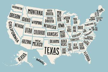
At a glance, the USA map shows a patchwork of 50 states divided by borders, but there’s much more happening:
- 48 contiguous states are connected in mainland North America
- Alaska lies northwest of Canada
- Hawaii is located in the Pacific Ocean
- The country is divided into regions: Northeast, Midwest, South, and West
- Each state has a capital, a flag, and distinct geographical features
The map also shows interstate highways, national parks, major rivers, mountain ranges, and urban centers—all key parts of understanding the nation’s layout.
🌎 The Four Major U.S. Regions
Let’s explore the country through its four commonly accepted census regions:
1. Northeast
Includes: New York, New Jersey, Pennsylvania, Massachusetts, etc.
- Known for: Dense urban areas, historical landmarks (Boston, Philadelphia), Ivy League universities
- Geography: Coastal plains, mountain ranges like the Appalachians
- Capital Cities: Albany (NY), Trenton (NJ), Boston (MA)
Fun Fact: The Northeast contains some of the oldest cities in the U.S., where the American Revolution began.
2. Midwest
Includes: Ohio, Michigan, Illinois, Wisconsin, etc.
- Known for: Agriculture, manufacturing, Great Lakes, the “Heartland” of America
- Geography: Plains, rivers, and forests
- Capital Cities: Columbus (OH), Springfield (IL), Lansing (MI)
Fun Fact: Chicago is the Midwest’s largest city and one of the busiest transportation hubs in the world.
3. South
Includes: Texas, Florida, Georgia, North Carolina, etc.
- Known for: Warm climate, southern hospitality, Civil War history
- Geography: Beaches, swamps, plains, and the Gulf Coast
- Capital Cities: Austin (TX), Atlanta (GA), Raleigh (NC)
Fun Fact: Texas is the second-largest state by both area and population, after Alaska and California respectively.
4. West
Includes: California, Washington, Colorado, Arizona, etc.
- Known for: Tech innovation (Silicon Valley), national parks, deserts, and the Rocky Mountains
- Geography: Mountain ranges, coastlines, deserts, and forests
- Capital Cities: Sacramento (CA), Phoenix (AZ), Denver (CO)
Fun Fact: California alone has a larger economy than most countries and is the most populous state.
🗺️ Key Features on the USA Map
When analyzing the map, there are a few geographical features that stand out and shape American life:
🌊 Major Waterways
- Mississippi River: One of the longest rivers in the world
- Great Lakes: Shared with Canada; vital for trade
- Colorado River: Carved the Grand Canyon
- Gulf of Mexico and Atlantic/Pacific Oceans: Crucial for ports and weather
🏔️ Mountain Ranges
- Rocky Mountains (West): Stretch from Canada to New Mexico
- Appalachian Mountains (East): Among the oldest mountains in North America
- Sierra Nevada and Cascade Ranges (West Coast)
🌲 National Parks and Landmarks
- Over 400 protected areas including Yellowstone, Yosemite, and the Grand Canyon
- National landmarks include Mount Rushmore, Statue of Liberty, and Golden Gate Bridge
📜 Historical Expansion: From 13 Colonies to 50 States
The USA began with just 13 colonies on the East Coast. Over time, the country expanded through purchases, treaties, and wars.
Major Events:
- Louisiana Purchase (1803): Doubled U.S. territory
- Annexation of Texas (1845)
- Oregon Trail and Westward Expansion
- Alaska Purchase (1867)
- Hawaiian Annexation (1898)
Each addition brought new cultures, geographies, and resources into the national fold, which are visible today on the map.
🧠 State-by-State Highlights (Mini Profiles)
Let’s look at some notable states and what makes them special on the map:
| State | Unique Feature |
|---|---|
| California | Home to the tech industry, Pacific Coast, and Hollywood |
| Florida | Peninsula state known for beaches and Everglades |
| Texas | Oil, cattle, and an independent history |
| New York | Global city and historic immigration center |
| Alaska | Largest by area, known for wildlife and glaciers |
| Hawaii | Only island state, volcanic origin, unique culture |
Each state contributes something unique to the tapestry of the nation.
🧭 Navigating the Map Today
Modern digital maps let you explore every inch of the USA:
- Google Maps & Earth: Zoom into cities, parks, and roads
- State GIS maps: Provide in-depth local data
- Tourism maps: Highlight attractions, trails, and routes
- Education apps: Use interactive quizzes to learn states and capitals
These tools bring the map to life, turning static learning into an immersive experience.
🏛️ Political Boundaries and Electoral Influence
The USA map is also a reflection of the nation’s political structure:
- Each state elects 2 senators
- The number of House representatives varies by population
- Electoral College votes are assigned by state
- Redistricting changes political boundaries every 10 years after the census
Example: California has 54 electoral votes, while Wyoming has only 3—yet both have 2 senators.
🌐 How the USA Map Unites the Nation
Despite regional differences, the USA map symbolizes unity:
- A shared federal system of governance
- Interstate highways connect the coasts
- Cultural and economic ties span across borders
- The American identity includes all 50 states working together
The map reminds us that although states have their own identities, they are all pieces of the same puzzle.
🧭 Tips for Studying the USA Map
Want to master the map? Here’s how:
- Start with regions – Learn the 4 major U.S. regions
- Use memory aids – Mnemonics help with state names and capitals
- Try map puzzles – Practice with drag-and-drop online games
- Make flashcards – Include flag, capital, abbreviation, and fun fact
- Explore virtually – Use Google Earth to “visit” each state
🏁 Final Thoughts
The USA map is more than a geographical document—it’s a visual representation of a diverse, resilient, and united nation. From rugged mountains to bustling cities, from deep forests to sun-soaked coasts, every state contributes to the character of the country.
By exploring the map in detail, you gain more than just knowledge—you gain a deeper appreciation for the land, people, and story of America.